GeoGoose

Mapping Services We Provide To Grow Your Business

GeoSpatial Modelling

Site Selection and Cost Surface modelling. Used to find “the best site possible” for given criteria, our models provide a way to find the most suitable site within a given area according to your set of criteria.

Map Based Apps

A collection of map-enabled mobile apps, empowering field workers to collect Information, GPS locations, Photos and Signatures

Our Projects

Our Latest Works

Hydro-power site selection

Intelligent site location modelling to find best sites for new hydro power facility.

Ocean Vessel Monitoring

GPS Tracking and monitoring of boat locations.

GeoSpatial Dashboards

Map-driven reporting on concession performance and tonnages.

Social Impact (SIA) Surveys

Design of smart survey forms to interview stakeholders and collect asset information

Our Customers

What Say Our Happy Clients

"We showcased the GIS atlas to our Director today. He is very impressed (and has seen a number of attempts on these type of studies)! Thank you, it was well received!"

Hydro Modelling
Hydro Modelling Global Board Member

"The work you have done for the industry is revolutionary"

Vessel Monitoring & Dashboarding
Vessel Monitoring & Dashboarding Conservation Director

"You are legendary! I couldn’t ask for any better. Thank you!"

EIA Director
EIA Director Director EIAs

Recent Updates

Our latest news

Geospatial mapping
Case Study: Environmental Mapping for EIA Projects

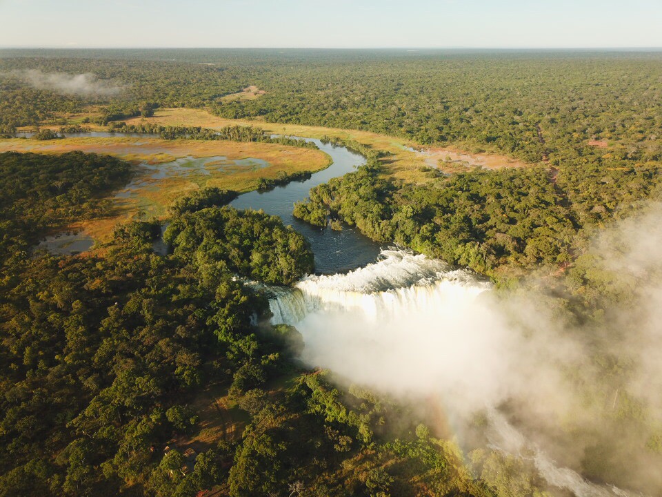
Producing a large-scale Environmental Impact Assessment (EIA) is an immense effort, spanning months or even years. The landscape is often unknown, and specialists are met with the daunting task of mapping and measuring its features for quantification,  diversity, and uniqueness.  Yet, Environmental Impact Assessments (EIAs) are a core part of responsible development, and like it or not, they ensure that new projects meet both environmental expectations and compliance obligations.

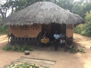
For Armitage Environmental and Social Consulting (AESC), a consultancy that delivers environmental and social services across Africa, success means more than just ticking a box. Their ability to deliver high-quality EIA reports relies heavily on detailed, practical maps and advanced field survey and mapping tools, which support informed decision-making in alignment with international standards such as the IFC Performance Standards and World Bank guidelines

AESC supports clients in the mining, energy, and infrastructure sectors. To do so, they need premium mapping services to support their scientists, field teams, and corporate mapping requirements. Over the last eight years, GeoGoose has worked closely with AESC to support them with reliable, purpose-built mapping and geospatial tools tailored to each project’s needs.

The Challenge

Many of AESC’s project sites are vast and remote. Mapping solutions need to be technically sound but also easy to use in the field- especially when time and accuracy are critical. Project requirements are broad, and our partners rely on GeoGoose to: 

Prepare them thoroughly with detailed desktop analysis. Field teams have a tough job, but being prepared makes navigating rough terrain easier.   

Enable them with easy-to-use mobile tools to accurately map, collect, tag, and organise environmental site data. Enabling them to perform accurate, complete, and comprehensive audits of all the biophysical and heritage features across the landscape

Produce ways for them to visualise and layer complex data clearly for use in reports, presentations, and public consultations. Giving them everything they need to deliver top-notch reports with professional, clear maps to meet regulatory requirements.

In short, there is no room for approximation. The environmental, financial, and reputational stakes are too high to risk outdated tools or generic maps.

The Solution: Field-Integrated Environmental Mapping

GeoGoose works closely with environment and social specialists to create a flexible mapping workflow that serves both data-heavy reporting and day-to-day fieldwork.

What does this look like in practice?

It means integrating GIS data layers with mobile tools that enable specialists to capture what they need, when, and where they need it. It means delivering maps that look clean in a report but carry the depth needed to support regulatory decisions. And it means working behind the scenes to make sure the tech is solid, the detail is there, and the outputs make people’s jobs easier and more efficient.

Mapping solutions include:

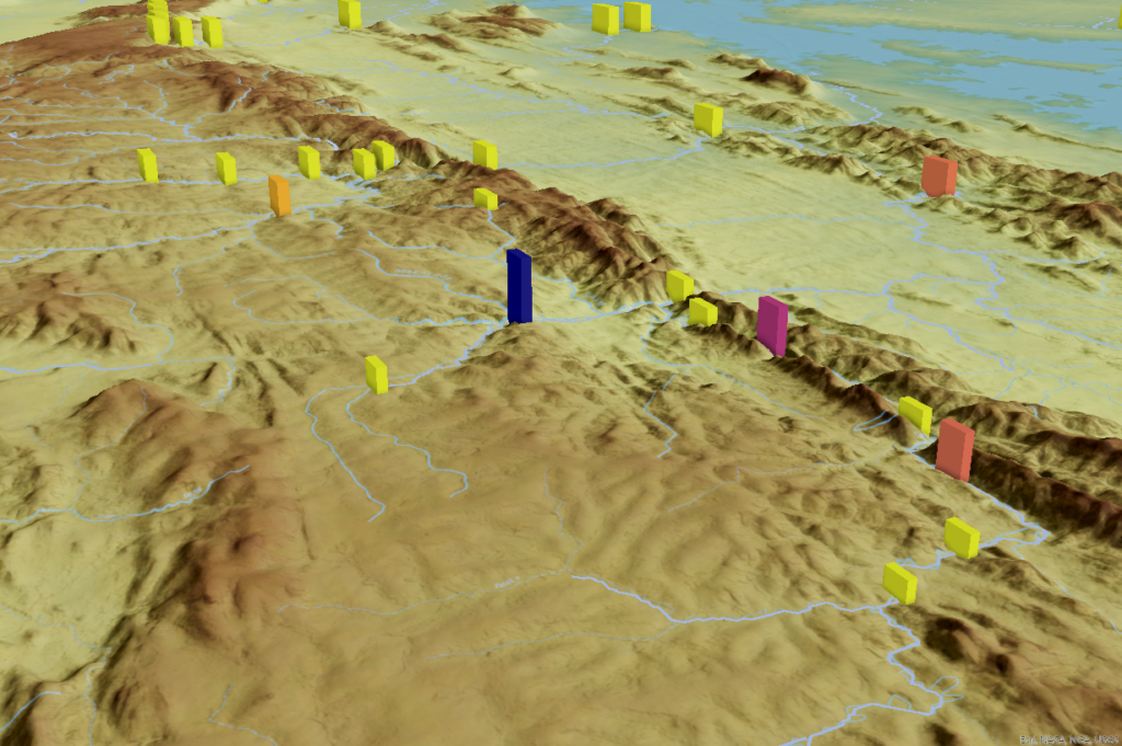
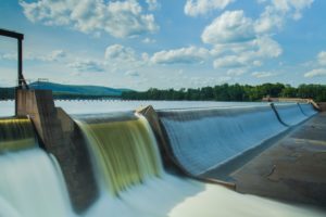
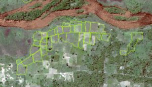
  • GIS mapping and data extraction of all key environmental elements for EIA reporting. This ranges from surface and groundwater to land use, vegetation analysis, measurement of biodiversity, and identification of sensitive and protected areas.
  • Overlays of regulatory datasets, including protected areas, species of significance and biodiversity hotspots – giving projects a clearer environmental context at national and global levels.
  • Production of maps in various forms, from paper-based maps to multi-page map books and even map-driven storyboards, makes it easy to share, collaborate, and review detailed plans.
  • Mobile mapping tools for field teams, with features that allowed them to record and tag field observations with photos and GPS coordinates, visualise proposed infrastructure layouts on location, and sync everything directly into the main mapping database.

The days of juggling with printed maps, hand-written notes, and disconnected data sources are gone. Now, we have an integrated system that works just as well in the field as it does at the boardroom table.

The Outcome


With GeoGoose’s support, AESC uses a streamlined system that adapts to the needs of each project, helping them to:

  • Cut down time spent on managing data.
  • Improve the accuracy and reliability of field data.
  • Improve collaboration across field and office teams.
  • Anticipate environmental red flags earlier, making the review process smoother and more proactive.
  • Submit clear, cohesive maps that support the credibility of their environmental reporting.

These projects demand more than off-the-shelf solutions. With every site presenting unique environmental conditions and regulatory expectations, the solutions have to be adaptable, precise, and built for purpose.

By delivering customised mapping support from planning to submission, GeoGoose helps ensure that environmental submissions are not only accurate and efficient but also decision-ready.

Hydro power site selection by geospatial modelling
Hydro-power Site Selection in East Africa – A Data-Driven Approach

Hydro-power is one of the most reliable and scalable renewable energy sources, generating more than 50% of all renewable energy produced globally. It holds enormous potential for the future of sustainable energy. As promising as hydro-power is, site selection still remains one of the biggest challenges for developers.

Choosing the ideal site for a hydro-power project is far more complex than just identifying a water source. Experts will know that for hydro-power projects to be viable and sustainable, they need to take into account river dynamics, environmental sensitivity, and long-term operational feasibility before a single shovel hits the ground. The wrong location can lead to wasted time, budget overruns, or even project failure.

Relying on limited field surveys or broad estimations leaves developers open to expensive miscalculations or worse. That’s why decision-makers need a defendable, data-driven plan. 

When a hydro-power developer in East Africa set out to identify the most viable locations for future projects across multiple countries, they needed a solution that could go beyond basic mapping. They turned to GeoGoose to leverage geospatial modelling and unlock a more precise, efficient, and informed way to select sites.

The Challenge

The client, a hydro-power developer in, needed a watertight way to assess potential sites at scale across multiple countries. Their choice of sites would be determined by:  

  • Sufficient water volume and flow rates for energy generation – The river/s needed to have a consistent, adequate flow to support sustainable energy output.
  • Minimal environmental and ecological disruption – Poor site selection could lead to habitat destruction, biodiversity loss, and regulatory hurdles.
  • Accessibility to existing infrastructure and transmission networks—To be operationally sustainable, sites needed to be close to power grids, roads, and workforce.
  • Compliance with local and international regulations – Understanding regulatory constraints early in the process prevents wasted time.

Our Approach: Geospatial Modelling for Smarter Decision-Making

To bring accuracy, efficiency, and insight to the site selection process, GeoGoose developed a Hydro-Assessment Atlas, a custom geospatial model designed to evaluate and rank potential hydro-power sites across vast river networks.

This model was delivered in two parts: 1 HydroSync Module, 2 HydroRefine Module.  

1 HydroSync Module allowed us to:

  • Map entire river basins, analysing millions of potential nodes to identify locations with high hydro-power potential.
  • Assess topography, watershed characteristics, and river reach metrics, ensuring that each location meets the necessary conditions for sustainable energy production.
  • Rank potential sites based on a weighted scoring system, prioritising locations that balanced energy generation potential with environmental and infrastructural feasibility.
  • Long-term operational sustainability – Prioritising locations that would remain viable even in the face of climate change and shifting water patterns.

One of the most valuable aspects of this approach is moving window analysis, which at a basic level, enables complex calculations at regular intervals along drainage lines. Using nodal scoring techniques, sites are objectively scored based on water flow, environmental risk, and accessibility.

Once high-potential locations are identified in the flow optimiser, the sites are filtered and refined in the 2 HydroRefine Module:

  • Regulatory and permitting feasibility – Ensuring that shortlisted sites comply with regulatory requirements and international environmental standards.
  • Environmental and social impact risks – Factoring in biodiversity concerns, proximity to sensitive habitat, local community impact, and potential displacement risks.
  • Layer additional data –  Incorporating auxillary critical factors such as existing infrastructure, environmental constraints, and regulatory thresholds to refine site suitability.

This methodology provided the client with an evidence-based, scalable, and highly efficient way to select the best possible sites for development.

The Outcome: Defendable, Data-Driven Site Selection

By leveraging advanced geospatial modelling and incorporating multi-thematic datasets, GeoGoose enabled the client to:

  • Shortlist the top 20 most viable sites across multiple countries, significantly reducing the time required for pre-feasibility studies.
  • Eliminate unsuitable locations early on, preventing unnecessary investment in evaluating sites that would later face challenges.
  • Streamline permitting and compliance, allowing the client to present data-backed site proposals that met regulatory requirements from the outset.
  • Optimise long-term sustainability, ensuring that selected sites would remain productive and operational for decades to come.

Instead of relying on guesswork or limited on-the-ground surveys, the client now had a clear, defendable roadmap for future development supported by spatially accurate, real-world insights.

Because when it comes to hydro-power and sustainability, the where is just as important as the how.

Want to see how geospatial intelligence drives smarter site selection?
Contact GeoGoose to learn more.